

Source: https://t.me/usinfantryman1/15820
Translation:
Importantly.
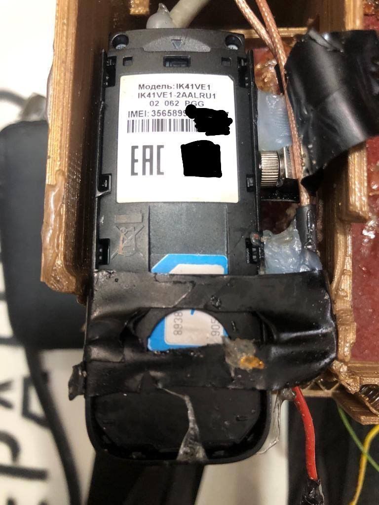
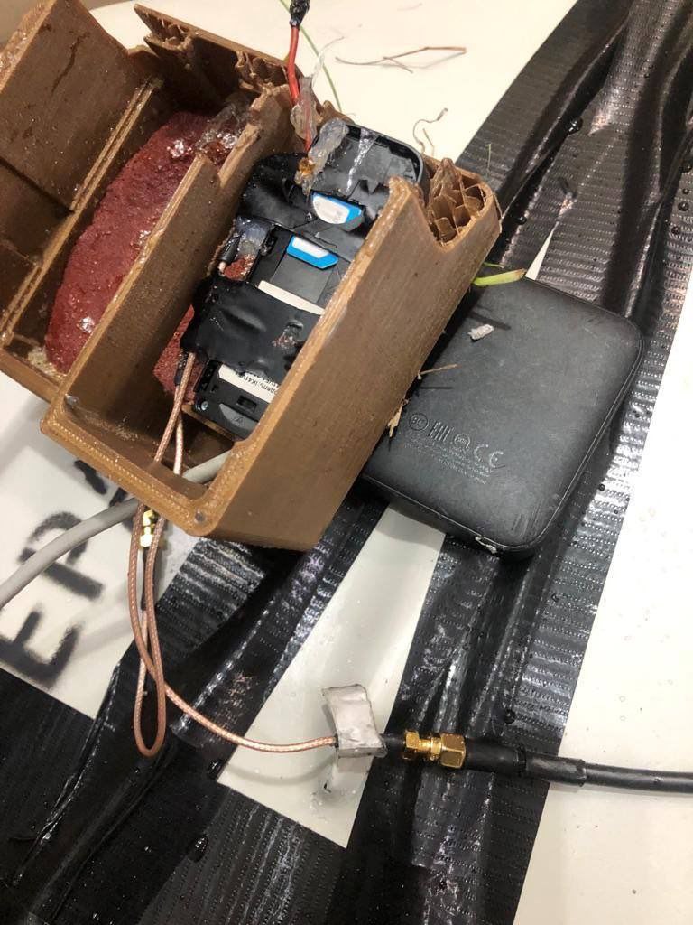
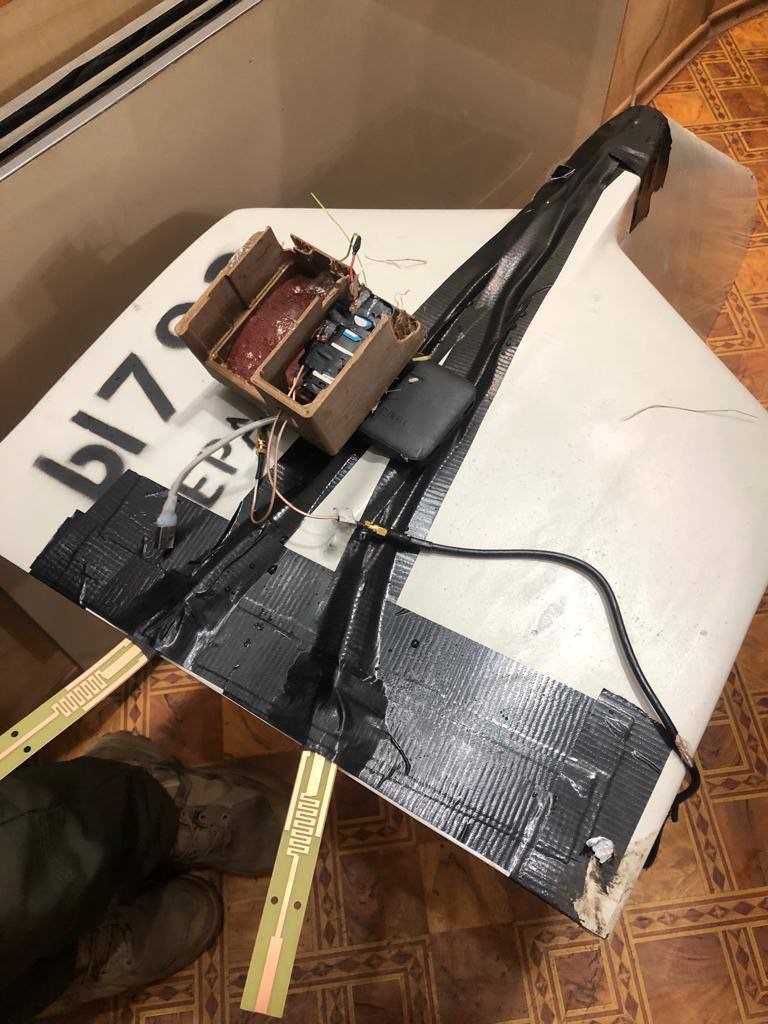
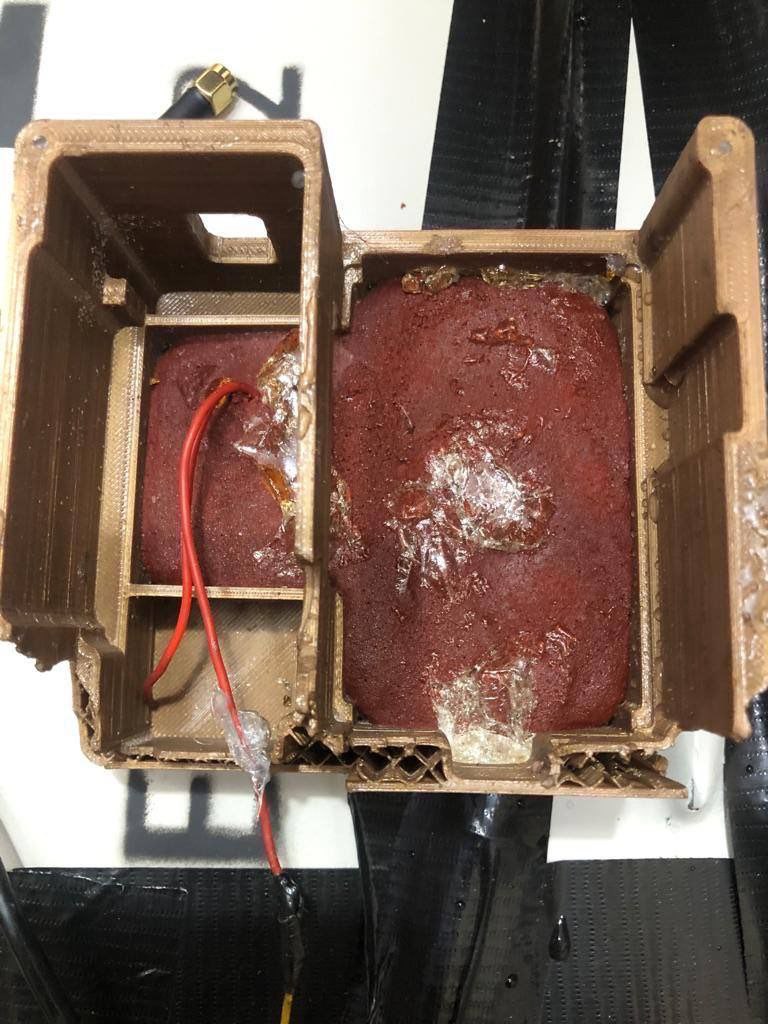
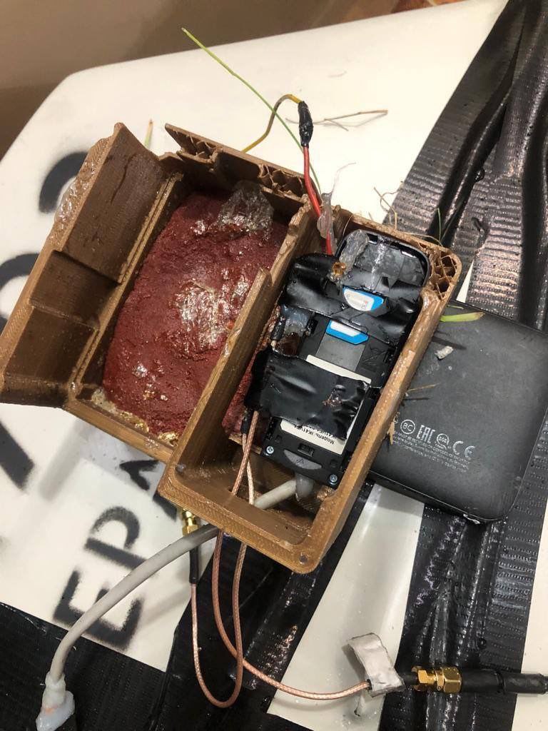
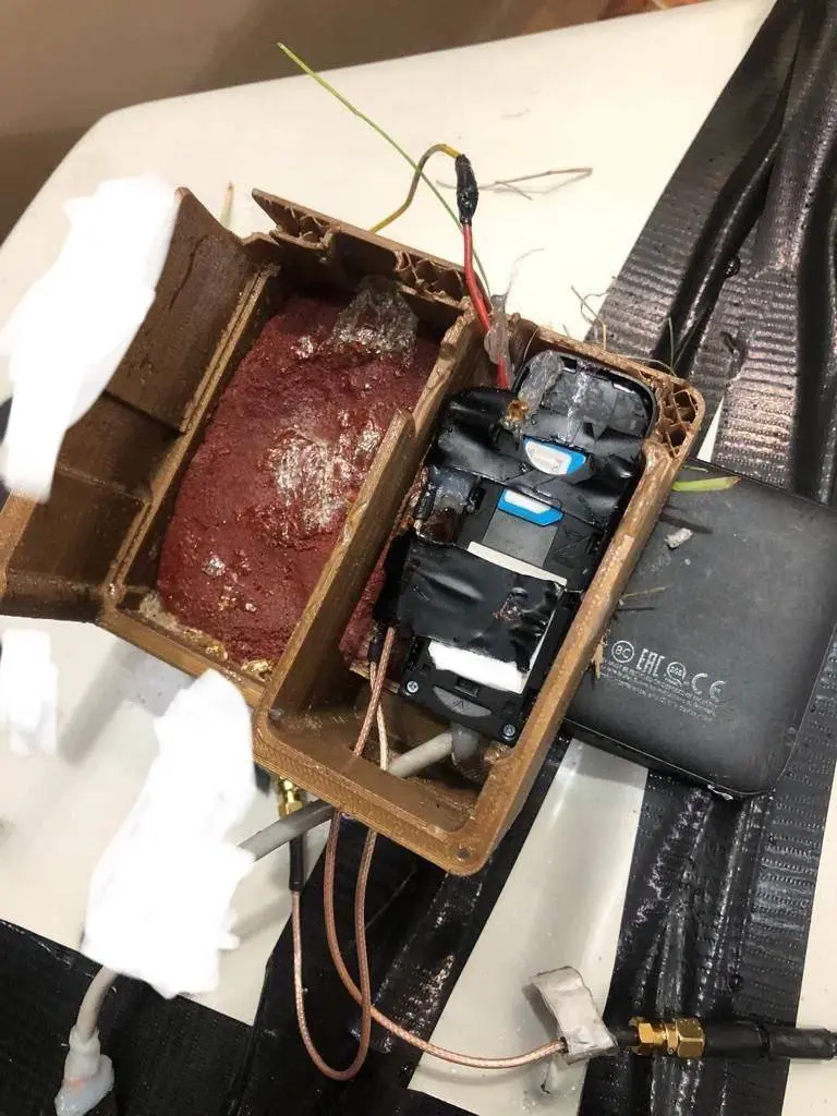
An ATM and a device with a Kyivstar SIM card were found inside the Podar Shahed.
That means they’ll be able to use the cellular network to update the coordinates of this shit, plus maybe be able to change the flight task.
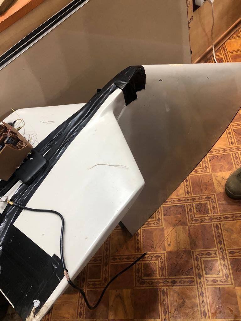
All this was located in a 3D printed element.
American infantryman
This looks like a great opportunity for Ukraine!
Most of the time I would imagine you, as the target of one of these, has zero ability to affect change in where the drone lands except by shooting it down. I would guess that these drones either use inertial guidance so they know where they are in space because of where they started and where they turned plus how fast they flew plus the outside forces like wind acting on them.
So the only way you can change their course is by shooting them down prior to this.
The orcs just gave Ukraine a backdoor (which Ukraine has ultimate control over!!) into the flying drone!
Knowing this Ukraine attack these drones in a whole bunch of new ways.
- locally spoofing cell tower locations (using a narrow “gun” type transmitter) so they could alter the course
- identify the upstream server that the drone is using to communicate with, and “man in the middle” the conversation to change targets or order it to crash in safe places
- in the most extreme, there’s the outside possibility that Ukraine could commandeer a drone in flight on the way to a Ukrainian city and *give the drone a Russian target to attack instead!
Purged by creator
If its used like the INU I had from GD to integrate, the INU is only supplemental to the guidance system. INUs drift surprisingly quickly in real life so I’d imagine it’s used in conjunction with cell triangulation, satellite positioning, mems compass, manual input, etc so that when one drops out (jamming maybe) its circle of error (I forget the correct term) doesn’t go big quickly.
Fun fact. An INU can figure out its position from an unknown one if its left stationary for a long time (1/2 a day iirc). Something to do with the rotation of the earth but the exact reason I forget.
I wonder how Ukraine can mix up the cell signals to prevent them being used as locating beacons without impacting their operation too much.
Could the cell tower ignore items moving past a certain speed unless whitelisted?
They could, but implementing such a system would require the cell tower to measure a device’s speed via the cell signal’s time-of-flight, which would require reprogramming or replacing the tower’s hardware.
And even that would only address half the issue, as the drones could still triangulate their position without connecting to them at all using nothing more than a table of cell tower locations.
GPS stops working above a certain altitude or speed regardless of whitelisting so that backdoors aren’t exploited
This isn’t GPS though, I don’t think the tower can measure altitude, only distance and speed?
Yeah I was saying that a whitelist is pretty dumb cause Russia could spoof a whitelisted device, or steal one and get its credentials, backdoors are never a good idea
Ah, gotcha.
These are launched from Russian territory, the cell towers can triangulate where a phone signal comes from. They just need software to cut off sim cards that start in russia and travel towards Ukraine
This is used for final guidance over Ukraine. It would probably be easy to have them not start up until they have entered Ukraine.
Do cell towers usually know the locations of the sim cards they are talking to? If so, that definitely seems like a good idea.
You can roughly “triangulate” position based off of the signal strength from a few tower locations. In the best cases, cell towers might utilize beam forming and you can get a good angle that a signal is coming from. All you need is two towers for that scenario.
I suppose that in some cases, the GPS on the phone could report the location, but I am not sure if that happens reliably.
Regardless, Ukraine has been leveraging their cell network for intelligence since the war started. Russia had to stop blowing up the towers since phones were, and probably still are, a primary form of communication.
Ok, whos using the pumpkin bread to power their cell phones?
im assuming that is the explosive.
Was pointing at 80-year-old maps not working?
Removed by mod


