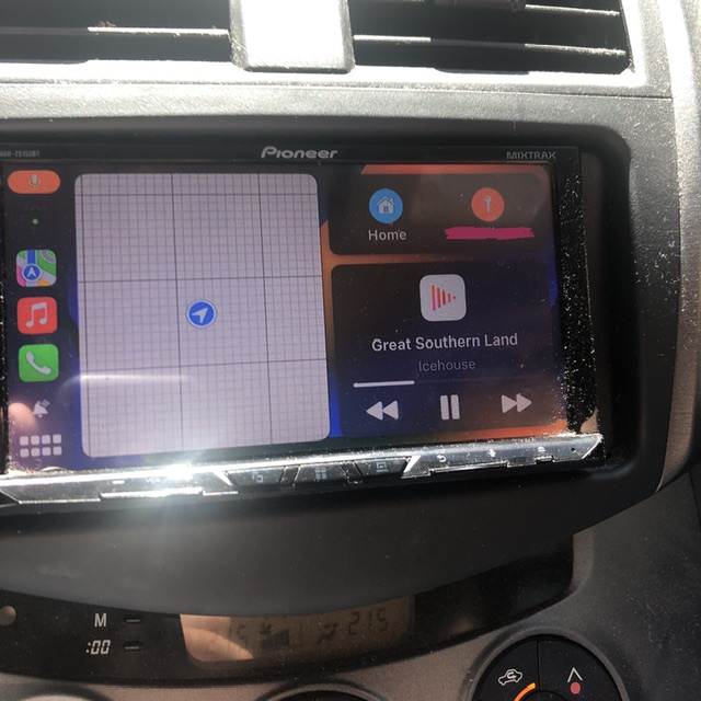
If I choose to drive on anything except the freeway, I get told the road is closed, drive it anyway (the road is, after all, not closed) and spend the entire journey with a mapless screen. Great 4G+ reception the whole way. Happens all over NSW. Weird.
Don’t use Apple Maps. Use Google Maps. It gets it right far more often. I still haven’t forgiven Apple for sending me on a Sydney motorway toll road loop. I know Apple Maps looks better, but that’s useless if the directions aren’t reliable.
Google Maps, not shown, had exactly the same problem. It repeatedly told me to turn around and tried to direct me onto a freeway (out of my way, but theoretically a possible route, I guess) and then it told me the road was closed, then got lost and decided we were nowhere. We still had coverage, and the downloaded map remained, but we weren’t on it.
Google maps does not know Newcastle, incidentally. It has repeatedly sent me on circular loops around my destination in Newie, and insists the tip has an entrance that doesn’t exist, among many other inconvenient wild goose chases. It’s fun to use, but gets massively unreliable outside Sydney. I cannot trust it, so I have both and check both when starting out.
Hmm have you tried moving to an area that isnt a grey, flat void?
With housing prices as high as they are right now you should consider yourself lucky if you could get a grey flat void.
Hey, don’t discount the lovely view provided by Repeating Grid!
Great song
Always brings me back to Yahoo Serious’s movies. I think it was Young Einstein that had that song in the intro.
deleted by creator
The maps were downloaded, I could read them and did, but moving or parked, the gps insisted I was at best “on a road that is closed”, and at worst tried to find me in the world. Not shown: Same problem with google maps, which also insisted that we weren’t on any road.
deleted by creator
I almost wonder if it’s the triangulation of cell towers (assisted GPS) at this point
No that wouldn’t be it.
The way GPS works, it takes a 12 minutes for the satellites to send enough data to calculate your approximate location. And note I said “send” enough data. Your device might not receive the data, especially since GPS is designed for very large (basketball sized) antennas mounted up high on top of a military ship surrounded by open seawater with no buildings, trees, car roof, etc for the radio signal to bounce off.
If your device already knows it’s approximate location, then the satellites are continuously sending data to calculate your precise location. So… with cell tower triangulation (or even better, wifi triangulation) to calculate an approximate location then Assisted GPS can get a lock on your exact location in a few seconds as long as you’re not surrounded by sky scrapers or in a tunnel.
Even if A-GPS isn’t available, your phone will just assume you are near the location you were last time it calculated your location. As long as you haven’t just hopped off an interstate flight that should work fine too.
deleted by creator
For over 100 km? probably not. This wasn’t a moment in time, it was the entire length, until we got on a more well known highway. At which point we “teleported” there I guess. It was all very weird.
If you were interested in trying another app, I love Waze and find its directions and navigation far superior to Google Maps (even though it’s owned by Google, go figure).
If you don’t mind trying a map app based on OSM, try Magic Earth. It has really good navigation for driving and you can even download large maps offline for a fraction of the storage it would take using Google or Apple.
Google bought Waze just to keep it out of anyone else’s hands. They’ve mostly ignored it after that.
They have integrated some of the crowd reporting stuff over to Maps. But that’s it.
download maps for offline use with osmand
Didn’t need to. I never got disconnected from the internet, only a 300km jaunt through rural NSW for the day.
The maps companies just insisted I was flying or something. They were lost, I wasn’t.
I’ve seen that happen when a highway was moved to bypass a town or when a windy section of road was replaced by a straight line cutting through the hills… sometimes the mapping companies don’t update the maps as quickly as they should. I’ve also seen them update the map a month before the new highway is open to the public… shrug
Never seen it on an established road that hasn’t changed recently though.
It was a perfectly normal road. Tarmac, two lanes one way, one the other, alternating, you know. Both Apple and Google maps insisted, yet again, that it was closed, then that it didn’t exist, then that we were nowhere. It has been happening more and more, on various roads, over the last six months. Never lost mobile connection. Got onto a highway 140km later, and it “found” me, as if nothing happened.
Yeah I’ve seen it happen a couple times on National Route 1 (that’s the route of highways that go through every major coastal city in Australia). The mapping data is, unfortunately, not as good as it should be.
I blame our government more than the apps. The government probably notified Apple and Google that the road was closed for bridgeworks or something like that and then and never sent a followup when the work was finished. Eventually they’ll figure out out and update the map (there’s a feedback feature built into both apps, which will accelerate the process).
… or you could use one of many apps that are based on Open Street Map. It’s sort of like Wikipedia for maps, and it works really well on dirt roads that Apple/Google/etc don’t bother to map at all. They work fine on tarmac too butt he estimated arrival time is rarely very good since those apps don’t collect data on how fast people normally drive though a sharp corner or how heavy the traffic is at 7am on a school day. The good thing is if you notice the map is wrong, you can just fix it. Won’t happen very often though, because millions of other people are already doing that. The commercial mapping companies would go bankrupt if they hired as many people as there are volunteering their time for free to edit Open Street Map.
Isn’t that a standard feature of Crapple CarPlay?
Edit: oh no, I’ve upset the fanboys, praise be to expensive inferior technology!
No, not for years. Except that it seems to be decaying over the last few months.
Not shown is the same argument I was having with Google Maps. Both insisted the road either wasn’t there, or was closed, which hasn’t been the case for the last forty years that I have used it.
This might be a very rare case if you’ve had the issue with different providers.
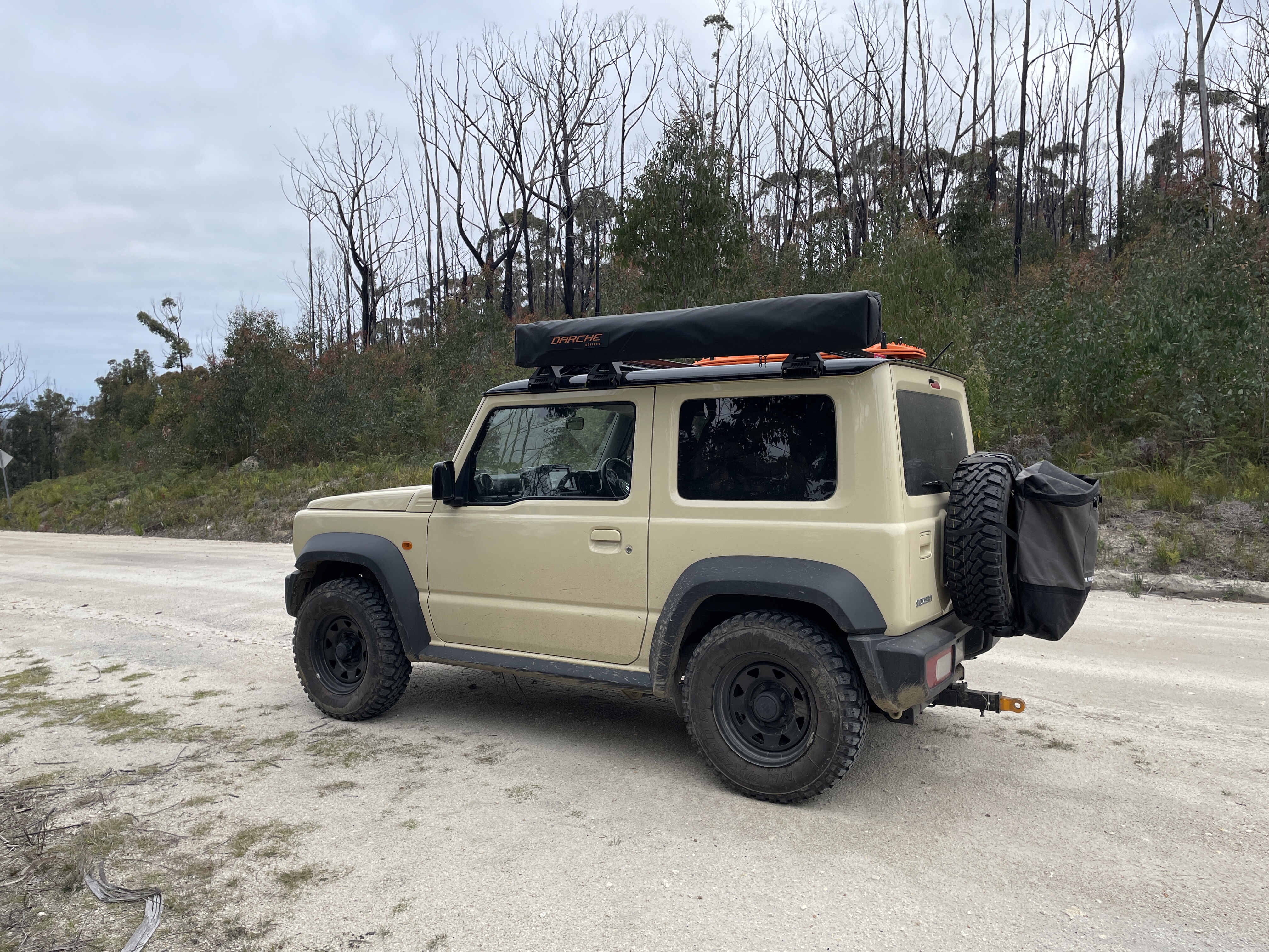
I 4x4 a lot, in regional NSW, and find that my pre-loaded Google maps show almost every single trail we’re on vs my friends with Apple or factory maps.
Either way, my comment was just tongue in cheek, do you remember the stories of Apple Map directing people into the ocean? 🤣
Yeah, I had all the maps, and the connection, I wasn’t lost, just the GPS was lost. I don’t 4X4, I’m just rural.
Yeah, there was a website called “TomTom is trying to kill me” many years ago, no idea if it still exists but I guess I should go look it up!
deleted by creator
deleted by creator
Different people will have different experiences in different locations.
In some locations Apple Maps is better, sometimes Google Maps is better, sometimes you have to resort to using Factory GPS (which is always terrible) and sometimes (Shock! Horror!) you have to navigate using road signs, your eyes and local knowledge.
That said, sometimes I wonder if an OSM navigation system would be much better. At least both Google and Apple allow you to provide feedback when something is wrong with their maps.
In newcastle I have generally found Google Maps innaccurate at best, adding massive legs to short trips at worst. Apple maps hasn’t sent me on doglegs yet in Newie.
Rurally, they’re both bad, but useable. But over the last year they have both got a lot worse.
I miss my NSW UBD paper book, frankly.
Settle down hero; my comment was a light hearted jab.
Have you ever used it? Have you experienced this bug yourself?
I’m on Android Auto, I live in regional NSW, I travel a lot and I regularly 4x4 in zero reception areas.
I’ve never had this issue, Google lets you know you’re going into bad/shitty reception areas and asks you if you want to pre-load maps. Only needs GPS when mobile data is zero.
I always find my Google Maps to be better than my fellow 4x4ers CarPlay maps.
Google lets you know you’re going into bad/shitty reception areas and asks you if you want to pre-load maps
Apple Maps pre-loads maps every time you get directions, and the latest version also encourages you to pre-load large areas (sydney is about half a gigabyte) even if you have perfect reception. It’s a free service that doesn’t monetise user data or have any ads, so Apple doesn’t really want iPhones hitting their servers continuously.
If you’ve pre-loaded your map, it downloads new data when you charge your phone overnight on wifi and only reaches out to the cloud for traffic data (and even then, it still has “typical” traffic based on time of day/day of the week as part of the offline map).
I always find my Google Maps to be better than my fellow 4x4ers CarPlay maps.
Sure, Apple Maps doesn’t do off road mapping at all. But CarPlay works with any (good) third party mapping app, including Google Maps and various dedicated off road mapping apps https://www.coffstrails.com/review-of-navigation-apps-for-4wd-adventures/
Your mates just don’t know how to use their phone is all.
Does it happen if you just use maps on the iPhone as normal instead of though car play? What iPhone are you using?
An X, and I have no trouble with it on city roads, I think it just has started doubting rural ones. Not shown is Google Maps doing exactly the same thing. I had downloaded maps, I didn’t need to, we were close enough to civilisation to have reception, but the gps insisted the road wasn’t there.
More and more rural roads seem to be dropping off the gps over the last six months.
Aww shit you went full Boolean man, you never go full Boolean man!
Try mapsme
I guess they are not great anymore. After they been sold their app is trying to put its fingers to many places in my phone it should not.
🤷♂️it works
The problem is that you’re listening to icehouse, a cheesy 80s band which tends to stuff up CarPlay and brick head units. Now drop that tucker mate, grab ya Shiela and get out beyond the black stump with some classic Queen or Aerosmith.
Sorry mate but “Great Southern Land” is one of our national anthems
Bite your tongue. Icehouse was amazing.


