
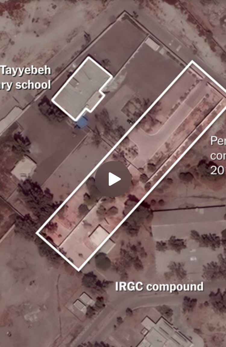
The school at one point was part of the Revolutionary Guards’ naval base, according to satellite images from 2013 reviewed by The Times.
The elementary school used to be part of the military installation that is still literally across the street – like 50 ft away.
IMO this looks like (shocker) the state sponsor of Hamas engages in the war crime of Perfidy.
We’re told that the U.S. and Israel have incredible intelligence capabilities, yet somehow Google Maps has better, more up-to-date imagery. That’s fucked up.
Even a PGM isn’t guaranteed to hit exactly one building and not next door. That’s why it’s a war crime to locate civilian installations right on top of military ones.
They were precision enough to hit the same spot twice. But I guess if your intelligence sucks that badly, so do your weapons systems.