
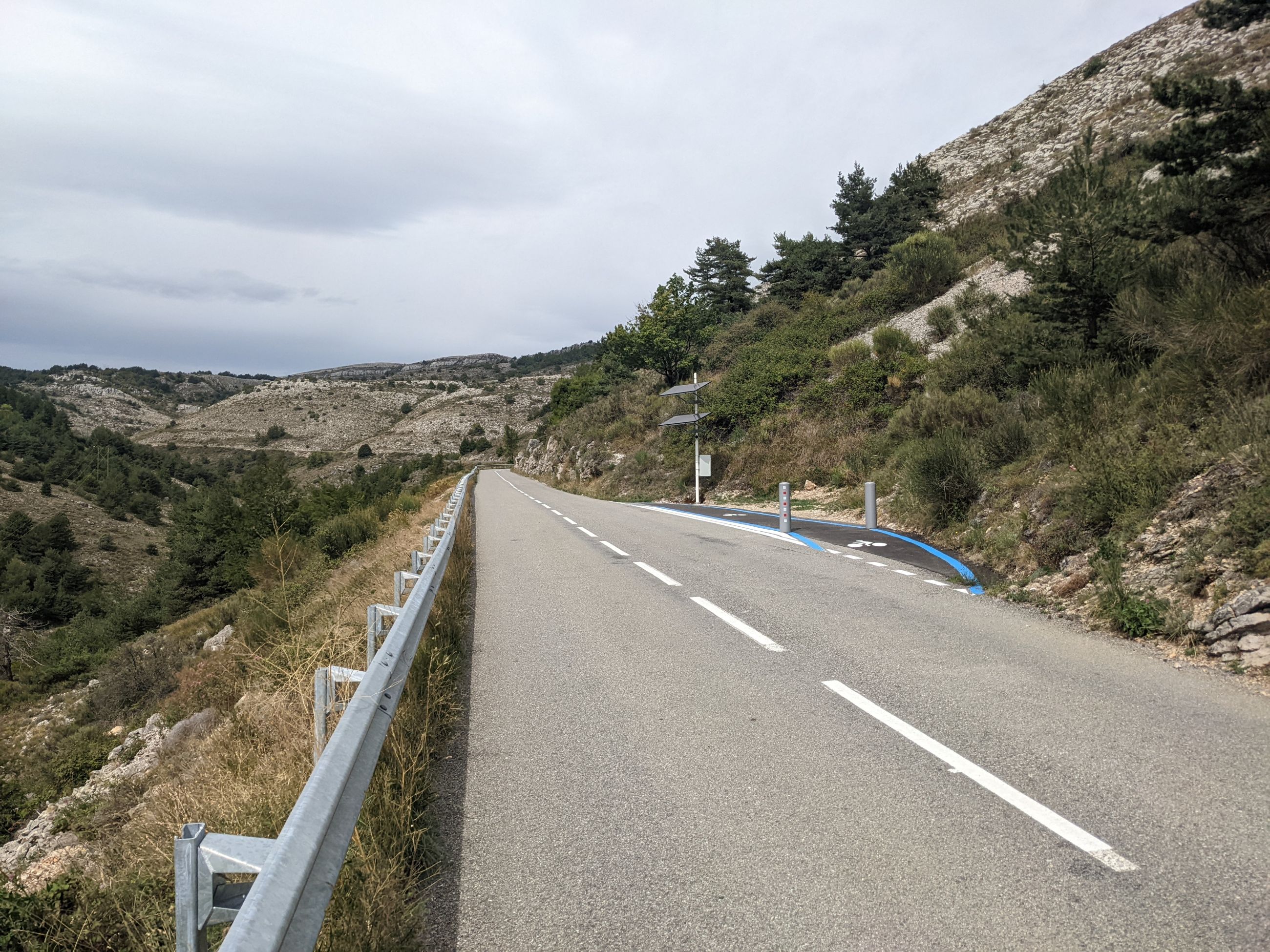
This is a photo from two years ago, i stood there for a good minute wondering how the hell and why this weird cycle path was there. It is in southern France, on the climb to Col d’Ecre, bit north of Nice.
Take a guess, i finally fully understand.
This is a photo from two years ago, i stood there for a good minute wondering how the hell and why this weird cycle path was there. It is in southern France, on the climb to Col d’Ecre, bit north of Nice.
Take a guess, i finally fully understand.
The solution
Oh…. The posts are the sensor that snaps a picture and uploads it
Now that i have found this, i kinda want to go back and collect the cols, haha.
Seems like quite some people snap a pic of themselves there. Not sure if it’s the best way to spend money on cycling infrastructure, but i think it’s a fun little project, i like it.
I still have no idea what it’s for
SPOILER
Maybe i was exaggerating when i said i fully understand it. There is this Cols Connectes thing from the department alpes maritimes where climbing a col is being gamified, to collect the cols and take the times, upload photos. And this infra is part of it, taking a photo. Maybe there is are also stations like this at the bottom and top, for the timing, but i did not see them if they were there. But i also rode some of the other cols and did not notice anything like it either, but apparently it’s there.
Just today i clicked on the deeplink to the cameras. https://www.cols-connectes06.fr/consultez-les-photos.htm I don’t know ho to reach this from their website.
I knew this infra was somehow part of “cols connetces”, but did not really understand what it did, i had asked it before in the french cycling subreddit.