
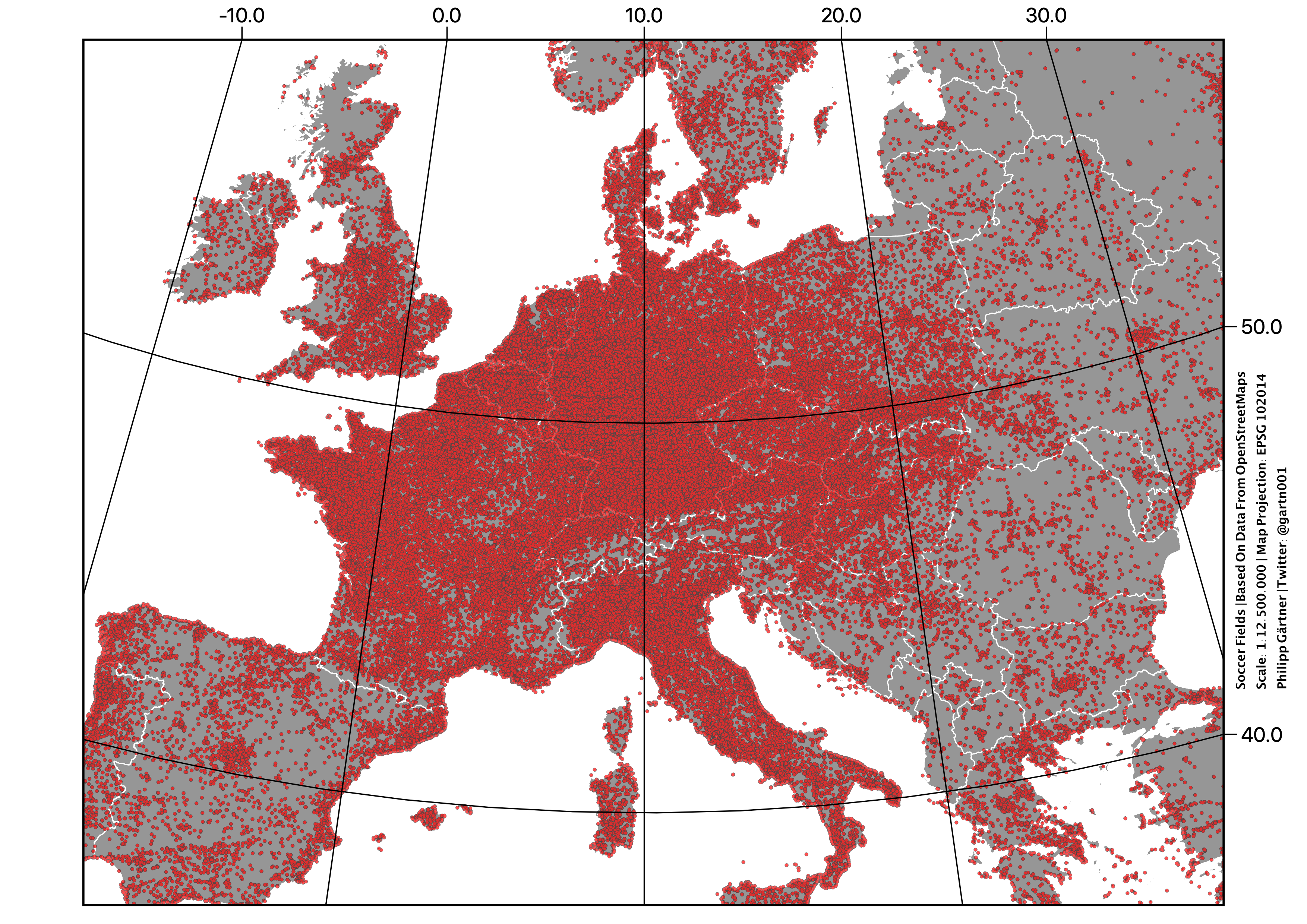
Germany: 45 630
France: 32 082
Italy: 26 139
England: 14 307
Spain: 10 999
Poland: 10. 37
The Netherlands: 7690
Sweden: 6036
Belgium: 5633
Austria: 5115
Ukraine: 4716
:
:
Vatican City: 0
Germany: 45 630
France: 32 082
Italy: 26 139
England: 14 307
Spain: 10 999
Poland: 10. 37
The Netherlands: 7690
Sweden: 6036
Belgium: 5633
Austria: 5115
Ukraine: 4716
:
:
Vatican City: 0
Football fields of continental Europe. This is blatant Nordic erasure and I will not stand for it!
Meaning I’m going to sit down because my legs are tired.
edit: also; isn’t this effectively a population density map? Wonder how it’d look if this was done per capita (for eg the population administrative unit each field is in)
Here’s an attempt to overlay this map with a population density one. It’s rough but I couldn’t think of a better way to show the info with what’s available. Red is still a football field, but now non-football-field land is green. Population density is blue. This means that football field + high density = magenta, no field + high density = cyan, field + low density = red, and no field + low density = green. Reference colours in the Bay of Biscay. It seems like the UK is basically a perfect density map, rural France loves football, eastern Europe in general is less bothered about the sport. I’m quite surprised by how few are in Spain too, given the country’s legacy in football
Ha now that’s pretty interesting. Funny how coastal areas look like they’re into football more than inland areas
The color scheme worked out really well for a quick solution, too. Good job!
Relevant xkcd:
https://xkcd.com/1138/
It’s still not a perfect overlap
On the following map high density areas without fields are in cyan, Ireland for instance is probably more rugby oriented:
Heh, figures