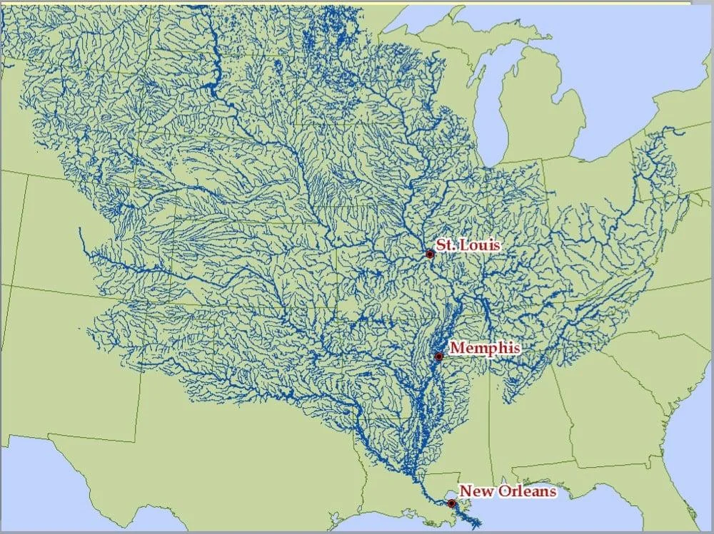
I imagine there’s other connections not shown near the Great Lakes since this is just showing the dominant south paths, but for the most part it does seem that the inner continent is higher north than south. Which given the geological history also makes sense, with the Canadian shield.


i guess rockies to the west and appalachia to the east means there is only one way for water shed to flow in middle north america
I imagine there’s other connections not shown near the Great Lakes since this is just showing the dominant south paths, but for the most part it does seem that the inner continent is higher north than south. Which given the geological history also makes sense, with the Canadian shield.